Early Fall Cycling: Friends Lake and the Hudson
On a clear Saturday afternoon in early autumn, two of us set out on a modified loop bicycle trip that featured a variety of scenery on Friends Lake and the Hudson River. We saw just early signs of changing leaf colors as we enjoyed other beautiful scenes on the lake and river.
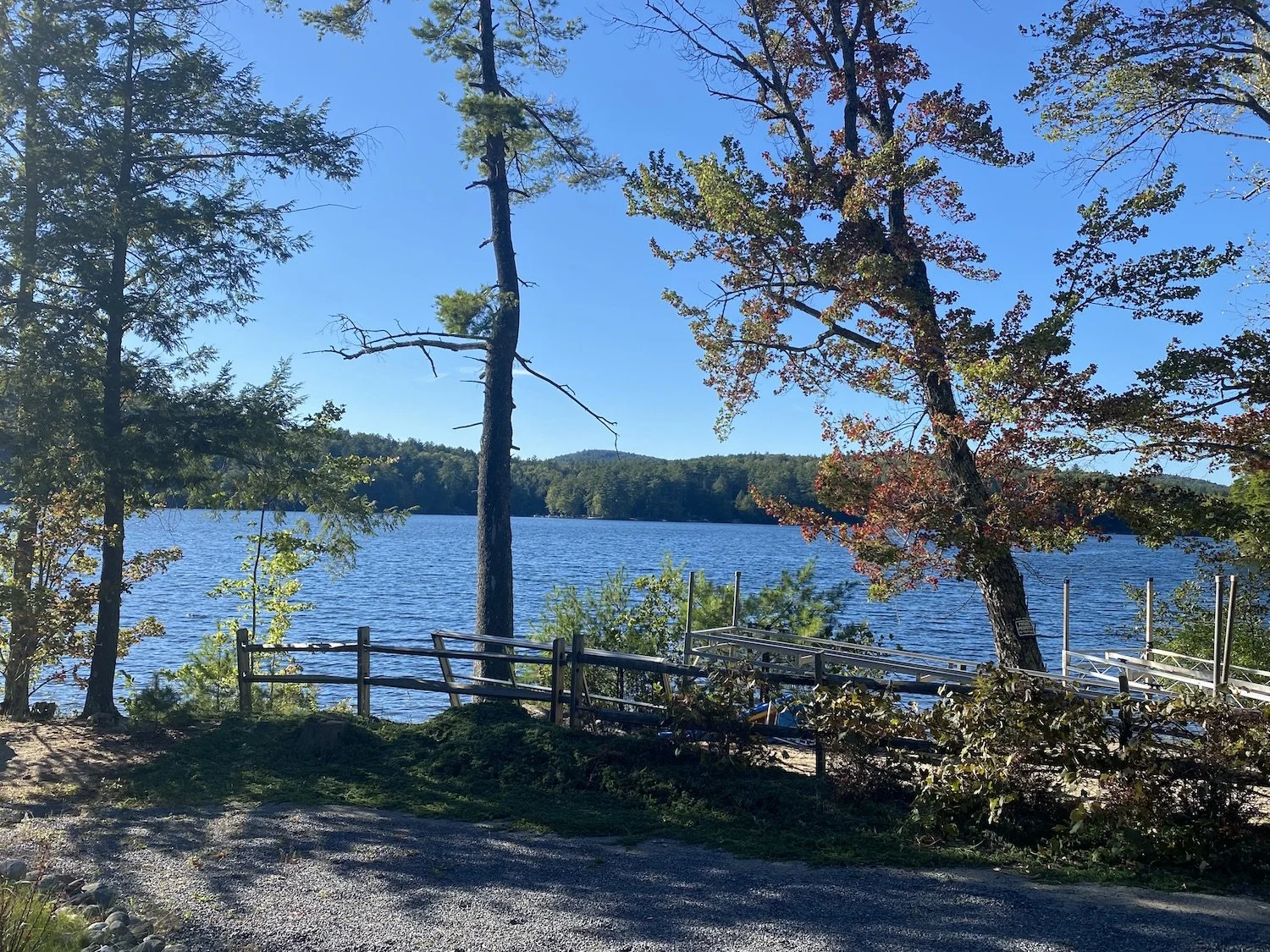
This section of Atateka Drive (County Road 46) offered glimpses of Friends Lake through the trees.
Friends Lake is one of Warren County's true gems. Near Chestertown, just three miles long and a half-mile wide with crystal blue water, its shoreline is scattered with residential development that maintains its natural beauty, quiet setting, and scenic views.
Setting out from the northeastern tip of the lake at the intersection of Stock Farm Road and Atateka Drive, we headed south on Atateka Drive (aka County Road 46), taking in views of the low sun of the fall afternoon sparkling on the lake. This section of the ride offered glimpses of the water through the trees, with occasional expansive views at clearings for boaters’ docks.
The road in this section was ideal, in both its condition and its absence of vehicular traffic. The surface very clearly had been recently repaved making for a smooth and level ride, and we encountered only a few motorists on the first few miles of the trip.
After 2.2 miles, with the lake now behind us, Atateka Drive took a right turn (becoming CR 74) at the Circle B Ranch, a popular destination for horseback riders. We were cordially welcomed by horses feeding on both sides as we made the turn.
Soon after the turn, the road enters a wooded area, providing both a shaded ride and a long downhill run toward the Hudson River. On this fall afternoon, the rays of light from the western sun gave us a pleasant visual experience through the trees on our way down from the lake.
After just under another two miles, we arrived at a T intersection, signaling the end of Atateka Drive and bringing the Hudson River into view straight ahead. Our left turn here took us onto Friends Lake Road, aka CR 8, offering views of the river to our right for just under a mile before the intersection with State Route 28.
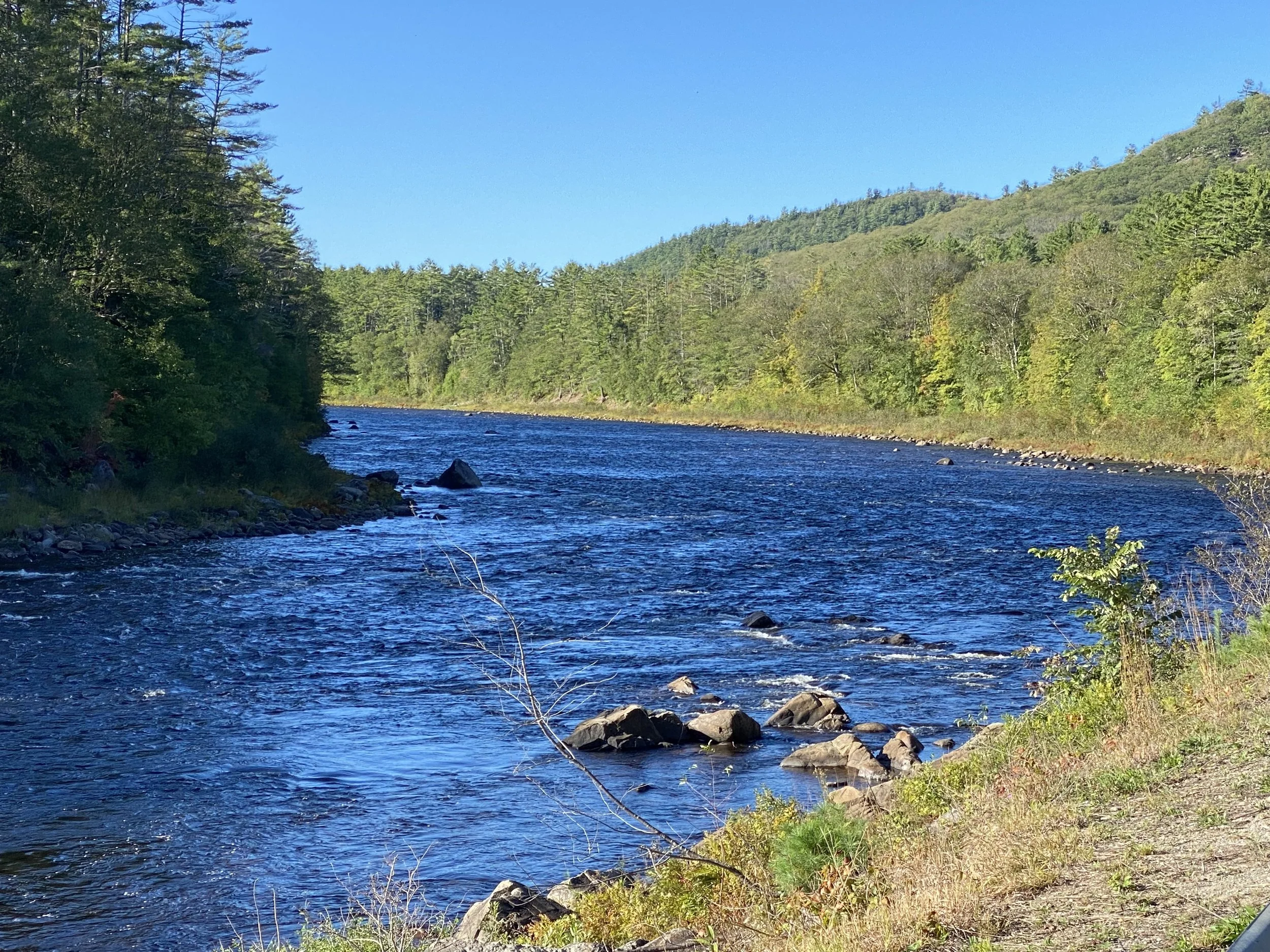
Our route offered miles of riding along the Hudson.
Here a hard right turn took us immediately across the Hudson at The Glen, on a heavily trafficked but wide-shouldered bridge from which we enjoyed expansive views of the river in both directions. After less than a quarter-mile, we very carefully executed a hard left turn at the Glen Lodge onto Glen Athol Road, and were welcomed by a sign into Thurman.
From this point until our turnaround, the trip featured a variety of views of the Hudson to the left, sometimes through the trees and others unobstructed. After just over a mile – and you have to look carefully or you’ll miss it – River Road branches off to the left to continue along the shoreline.
After stopping several times to take closer looks at the river – and during one stop to exchange stares with a herd of deer – we arrived at the Glen-Hudson Campground, across the water from the Hudson River Recreation area.
As the late-September sun continued its early descent, we retraced our route back to The Glen. From there we decided to add some distance rather than climb the long hill up Atateka, and rode an additional 2.2 miles on the narrow shoulder of Route 28 to Potter Brook Road, aka CR 46. Our left turn there took us up a more gradual incline through wooded terrain and farmland, 5.6 miles to our point of origin at Stock Farm Road.
Our total distance was 23.7 miles, at an average speed of just over 13 mph, with a total accumulated elevation gain of 1119 feet.
A great ride for a bright early fall afternoon.