A Deep Dive into Dippikill Mountain and Pond

View of the Hudson River and the mountains of Lake George and Vermont from a lookout off Dippikill Mountain. (Credit: John Sasso)
Dippikill is a private wilderness retreat owned by the Student Association of the University at Albany.(1) Stretching over 1,000 acres of land in the northern end of the Town of Thurman, Warren County, the retreat encompasses Dippikill Pond and the south half of its like-named mountain, which lie just west of the Hudson River. Since its inception in 1956, Dippikill has adhered to its mission: “To keep the area pristine, limit development, and offer visitors a glimpse of nature's beauty while enjoying overnight visits in rustic-style lodging.”
The claim often made is that the silly-sounding name, Dippikill, is Dutch for “small stream.” My intention in this historical profile is to explain why there is no merit to this claim, thus, throwing water on it (pun intended). I will, however, provide a plausible interpretation of the name and provide two examples of natural features in this state that were named similarly.
NOTE! As of 2019, access to the Dippikill retreat is closed to the general public. The cabins and campsites at Dippikill are open to reservations from University at Albany undergraduates and University at Albany affiliates: graduate students, alumni, faculty and staff. Please do not trespass on the Dippikill property!
A History of the Name
A portion of the northeast part of the Town of Thurman, from the County Atlas of Warren, New York, published by F. W. Beers and Company in 1876. Dippikill Pond is denoted “DIPKILL POND.” (Source: Warren County) / Click to expand
A portion of the 1958 USGS North Creek quadrangle map, where Dippikill Pond first appeared as its present name. (Source: USGS topoView) / Click to expand
Dippikill Mountain derives its name from the pond at its southern foot. The earliest reference to Dippikill Pond found is in F. W. Beers & Company’s 1876 County Atlas of Warren, New York, where it is denoted “DIPKILL POND” on the map for Thurman. The current name would come about when the USGS denoted “Dippikill Pond” on the 1895 edition of its North Creek quadrangle map. The mountain was christened much later when it appeared on the 1958 edition of the same map.
The name Dipkill continued to be used into the early 20th century, such as when a club named the Dipkill Lake Club was formed on November 22, 1924. (2)
Now, to address the claim that Dippikill – ergo its predecessor, Dipkill - is derived from the Dutch term for “small stream.” An examination of numerous texts on Dutch linguistics (including those from the 18th and 19th centuries) and historic literature related to the Dutch in New York State do not bear this out. It is well understood that “kill” is derived from the Dutch term “kille,” meaning a water channel. “Kill” has been applied to numerous places in the state, such as Kaaterskill (possibly “cats stream”), Poestenkill (“foaming water”), and Plattekill (“calm stream”). Neither “dippi,” “dip,” nor similar-sounding word in the Dutch language equates to “small,” “tiny,” “little,” or similar.
Second, a term comprised of a noun preceded by an adjective connoting smallness translates to a diminutive word in Dutch. The corresponding diminutive will have one of four suffixes applied (depending on the phonology of the word applied to): -the, -etje, -pje, or -kje. For example, the diminutive form of “kill” is “killetje.” Clearly, “dippikill” and “dipkill” are not Dutch diminutive forms. The complex topic of Dutch diminutives and their history are thoroughly discussed in William Z. Shetter’s 1959 paper, The Dutch Diminutive. (3)
A portion of the 1894 USGS Coxsackie quadrangle map (1904 edition) showing a creek named Diep Kill. (Source: USGS topoView) / Click to expand
If the former term, “dipkill,” is not derived from a Dutch term for “small stream,” then that begs the question: does it have its roots in Dutch? The answer is: it likely does. “Dip” appears to correspond to the Dutch word “diep,” meaning “deep” or “profound”; (4) when applied before a noun, it becomes “diepe.” Thus, “dipkill” may be the English corruption of “diepe kill,” meaning “deep stream.”
I posed my conjecture to Dr. Charles T. Gehring, director of the New Netherland Research Center of the New York State Library (5) and one of the foremost experts on the history of New Netherland, the first Dutch colony which included today’s State of New York.
Dr. Gehring replied: (6)
“Those forms spelled Dippikil would be non-Dutch attempts to imitate the original pronunciation, i.e., /Diep/ with the adjective ending /-e/ while those spelled Dipkil reflects the original meaning, i.e., Deep Kill (without the adjective ending). "Little stream" would be spelled /Kill/ with the diminutive ending /-tje/ or /-etie/as in Pannekoek Killetie, Little Pancake Kill in Schenectady County.”
A portion of a map of allotments in the Hyde Township, created on April 13, 1811. The map shows that many of the lots were owned by Peter Stuyvesant, a descendant of the Dutch Director-General of New Amsterdam by the same name. (Source: New York State Archives) / Click to expand
The appellation “diepe kill” for a stream or brook in the state is not without precedent. The brook which crosses New Baltimore-Coxsackie town line in Greene County and empties into Coxsackie was referred to in the 1890s as Diep Kill.
In his chapter on Coxsackie in the 1884 text, History of Greene County, New York, William S. Pelletreau states that the “brook was called by the Dutch settlers the ‘Diep Kil,’ or Deep Brook.” (7) Deep Kill, the brook that forms the northern line of the Town of Lansingburgh, Rensselaer County, was referred to as “Diepe Kill” and “Deepy Kill” around 1819, when a portion of the Town of Schaghticoke was annexed to Lansingburgh. (8)
How applicable the term “deep” is to Dippikill Pond or the stream it feeds is unclear. But, suffice to say, the oft-made claim about the name’s Dutch origin holds no water (again, pun intended).
Very little has been documented about the legacy of the Dutch and their descendants in Warren County. The county was first settled in the spring of 1766 by Abraham Wing, who was of English descent. (9) Subsequent arrivals were Welsh, Irish, Scots, French, and Dutch, in that order. (10)
By the outbreak of the Revolutionary War, there were no more than forty families living in Warren County, many of whom fled “the menace of the war torn frontier.” Many returned in 1783 as resettlement of the county began.
An 1811 map of a Colonial-era land tract called the Hyde Township, denoting the ownership of various lots within, shows that a man named Peter Stuyvesant owned several of these lots (including those in the present-day Dippikill retreat).
This gentleman appears to be the Peter Gerard Stuyvesant (1778-1847), and American landowner, philanthropist, and the great, great grandson of his namesake, who was the Dutch Director-General of New Amsterdam, of the Dutch colony of New Netherland.
The Lead-Up to the UAlbany Student Association’s Dippikill Retreat
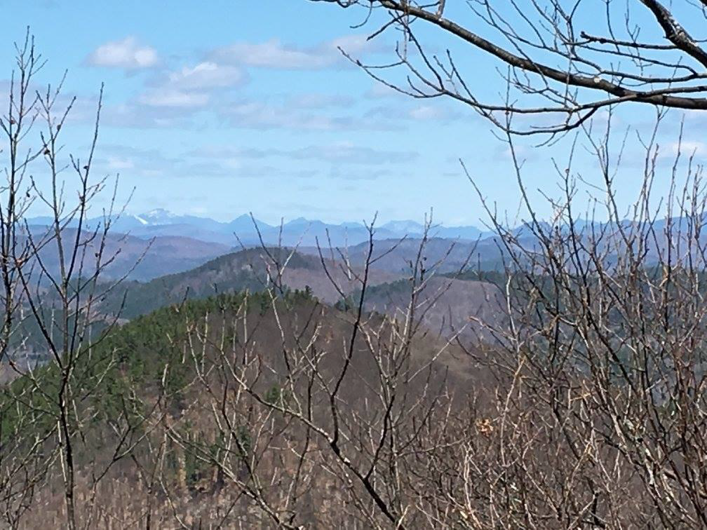
View of the High Peaks from Dippikill Mountain. (Credit: John Sasso)
Understanding how UAlbany’s Student Association came to acquire the land which makes up today’s Dippikill retreat meant poring through Warren County deed records and reports of sales in newspapers. Most of the retreat’s land is on Lots 27, 39, and 40 of a 40,000-acre, Colonial-era land tract called the Hyde Township (also known as Jessup’s Patent), (11) which are referenced by the deed records and reports found. I should note that the Johnsburg-Thurman town line which crosses the summit of Dippikill Mountain coincides with the north line of this township.
A 370-acre portion of Lot 39, which includes part of the pond and the south half of the mountain, was owned by Paul W. and Mary P. Williams until they sold it to the newly-formed Dipkill Lake Club in November of 1924. (12) The club, in turn, conveyed the land to Irving P. Goodman in 1953 as part of a tax sale. (13) Irving also acquired the northern subdivision of Lot 40 in 1948, which includes the southeast portion of the mountain by the Hudson River. (14) Irving was the brother of one of the club’s original directors, Thomas E. Goodman. He and his wife, Florence, owned and operated a tourist home in the hamlet of The Glen, just east of the mountain. (15)
On June 22, 1956, Irving conveyed these parcels, comprising at least 700 acres, to the Faculty-Student Association of the New York State College for Teachers at Albany for $1. More land would be acquired by the Faculty-Student Association later on, bringing the total amount to about 1,006 acres (as per the most recent land records, as of this writing).
As for the north half of Dippikill Mountain, which lies in the Town of Johnsburg, it was part of the State Forest Preserve by 1911. Today, it is part of the State’s Wilcox Lake Wild Forest, which is about 125,000 acres in size.
Today, the Dippikill retreat is the largest student-owned natural preserve in the country. It has ten lodges, four campsites, canoe access to the pond, and several trails including the Ridge Trail, which goes to the top of Dippikill Mountain. Rick Nelson, who served as Dippikill’s first caretaker from 1964 to 1996, began laying out trails on Dippikill's land in 1968, some of which followed old logging roads. (16) In August of 2019, the retreat closed access to its trails, which used to be available to the general public for hiking, skiing, and snowshoeing. The closure was declared due to concerns of people abusing that privilege, through the abuse and misuse of the property. (17) I am happy and fortunate to have been able to hike in Dippikill and reach the summit of its mountain back in the summer of 2017.

John Sasso is an avid hiker and bushwhacker of the Adirondacks and self-taught Adirondack historian. Outside of his day-job, John manages a Facebook group, History and Legends of the Adirondacks. John also has helped build and maintain trails with the ADK and Adirondack Forty-Sixers, participated in the Trailhead Steward Program, and maintained the fire tower and trail to Mount Adams.