Diamond Brook Bushwhack to Siamese Ponds Trail

This was our route, starting at the intersection of Edwards Hill Road with Sugar Hill Road, and ending at the Eleventh Mountain Trailhead on Route 8. We kept the massive Eleventh Mountain on our left and Diamond Brook on our right, crossing a dozen feeder streams as we went.
Our explorations of the First Wilderness of western Warren County in recent months had taken us to the Bog Meadow Trail toward Height of Land Mountain, and the more ambitious Siamese Ponds Trail from Bakers Mills. Both were enjoyable hikes along well-marked trails.
On a chilly December 1 with snow in the air, Dan Forbush, Tom Denny and I – the minimum number in a hiking party for us older folks – set out to make a connection between those two trails. The resulting plan was a bushwhacking traverse circumnavigating Eleventh Mountain, an imposing series of peaks known to some early hikers, because of its water features, as Cataract Mountain. More on that later.
Starting Out

It was a 7.2 mile, five-hour hike with just over 700 feet of elevation. That long descent was our bushwhack along Diamond Brook. When we reached the Siamese Ponds Trail, we turned sharply upward.
We began by leaving one car at the Eleventh Mountain trailhead on Route 8, then drove up to Edwards Hill Road, parking at the intersection of Edwards Hill and Sugar Hill Road. With the temperature in the high 20s and light snow still falling, we started the hike by heading up Sugar Hill Road.
Soon, off to the left through the trees, we saw the remnants of the "Old Log Cabin" to which Paul Schaefer devotes a chapter in Adirondack Cabin Country. He and his brother Vincent bought it in 1926 from Johnny Morehouse.
"It was situated in a highland meadow that reached to a brook at the foot of a precipitous mountain,” Schaefer wrote. "A main trail into a vast mysterious wilderness passed its door."
That meadow has vanished with the growth of trees and only the chimney remains from that cabin, but the trail is still there. That's what we followed.
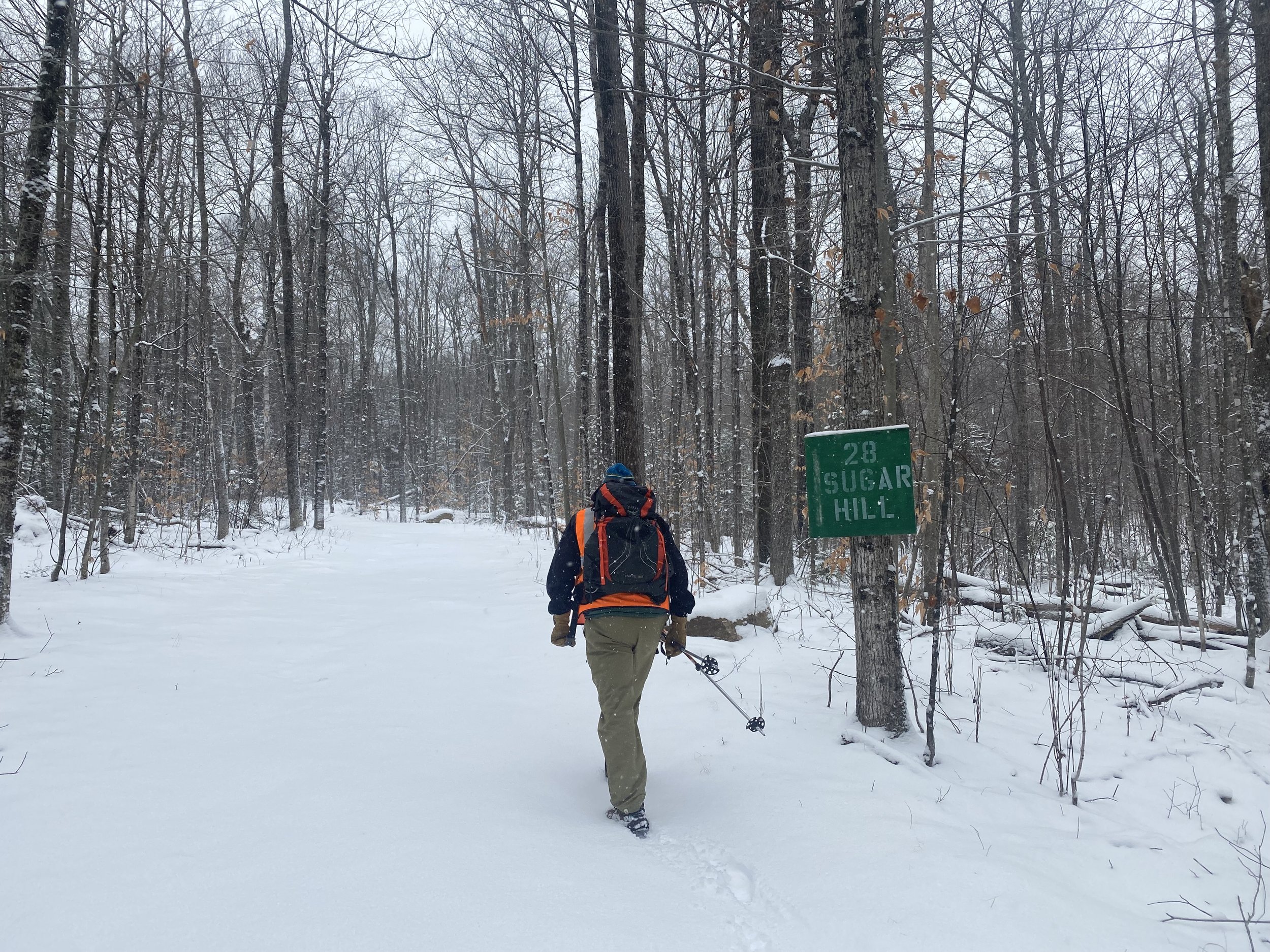
A half-mile in from Edwards Hill Road, we left Sugar Hill Road and entered the forest.
After about half a mile, at a sign for 28 Sugar Hill, the trail turns slightly to the right off the road and into the woods. By this time the snow had reached a depth of a couple of inches, but the footing was fairly stable without microspikes or snowshoes, as it would be for much of the hike, with a few slick spots along the way.
The views along this stretch – on this day with continued snowfall, and vistas through the trees – were similar to those we would encounter for the rest of the first section of the hike. After another mile or so, we came to the fork in the trail where the Bog Meadow Trail branches off to the right, and the path toward Diamond Mountain Meadow veers to the left.
The Diamond Mountain Meadow path – more of a herdpath than a real trail – follows a mostly slight downhill slope, the path disappearing into the woods just before reaching Diamond Brook. And this section of the hike gets us back to the subject of Cataract Mountain.

We’re pretty sure this is Diamond Mountain Meadow, where Paul Schaefer’s Cataract Club made their camp each November for a ten-day deer hunt.
Paul Schaefer was known to refer to Eleventh Mountain as Cataract Mountain, because of the waterfalls and cascades on several of its peaks. And Diamond Mountain Meadow, which we encountered on this hike, was near the site of Deer Week, an annual camping gathering of Schaefer and his cohorts during deer hunting season.
About two miles into the hike, Diamond Mountain Meadow is where the heavy bushwhacking began. For the next 3.5 miles of the hike, we worked our way through the underbrush and over fallen trees and limbs.
A Dozen Feeder Streams
Our strategy, led by our good friend and intrepid guide Tom, was to maintain an accurate orientation between Diamond Brook on our right and Eleventh Mountain on the left. This was often tricky because of deviations in the terrain, blowdowns in sections we needed to cross to stay on course, and icy patches on the ground and downed trees.
Another challenge was a series of feeder streams emptying into Diamond Brook, making for uneasy crossing by rock-hopping on wet and often slick surfaces. For two miles or so after leaving Diamond Meadow, we encountered about a dozen such crossings, but fortunately navigated all of them without serious incident.
After the first three miles of the bushwhack, knowing that continuing to follow Diamond Brook to its intersection with the East Branch Sacandaga River would add significant distance, we turned to the southeast on a more direct route to the Siamese Ponds Trail. This route involved gaining some elevation as we crossed the northern slope of Eleventh Mountain. After half a mile we broke through the trees onto Siamese Ponds Trail.
Turning left toward the trailhead, we immediately headed up the snow-covered hill and gained significant elevation over the next mile. We completed the hike with a final half mile downhill to the Siamese Ponds Wilderness parking area.
Totals for this hike: 7.2 miles, 748-foot elevation gain, just over 5 hours and 15 minutes, including brief stops along the way.